A Detailed Approach
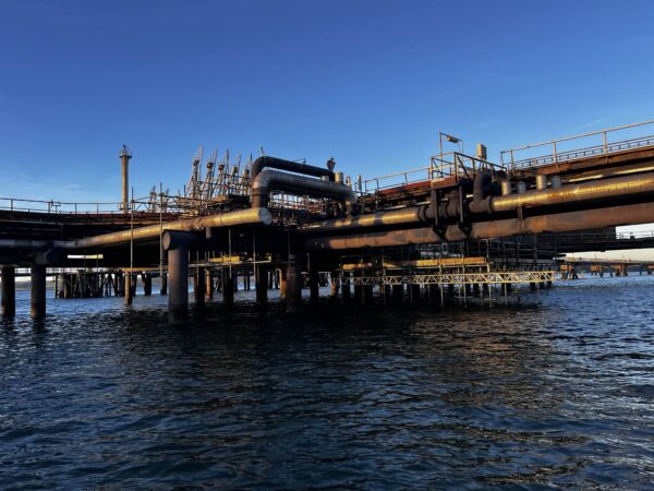
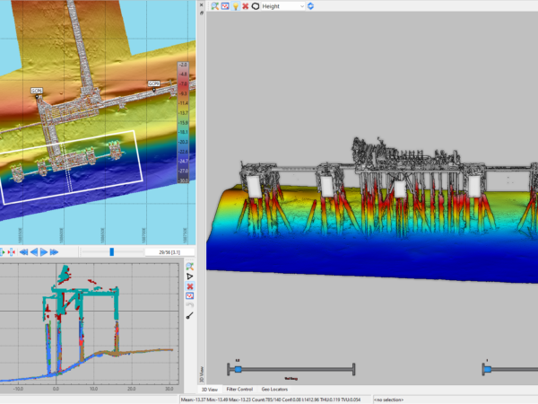
LandScope have recently completed a detailed structural inspection of a fuel terminal in South Wales. The scope of work included for high-resolution multibeam sonar modelling of the seabed, with extra focus on scour and accretion associated with the jetty piles. Additionally, high-resolution LiDAR and 360° panoramic imagery was specified above the water line.
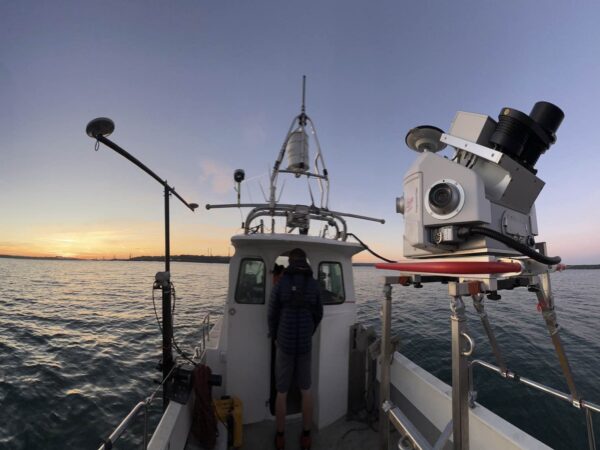
Our survey vessel “Investigator” was fitted with Norbit multibeam sonar, Leica Pegasus P2u mobile mapping system and the Mosaic 51 mobile camera system. The survey team worked tirelessly around the constraints of weather, sea-state, tides and light conditions to assemble the most complete high-resolution dataset.
In collaboration with our marine structural engineer, LandScope will deliver a detailed condition report with reference, where possible, to the previous inspection of 2012.
For further information on our marine infrastructure inspection services please contact us.